SKU: SENS-1442
📋 GST Invoice Available

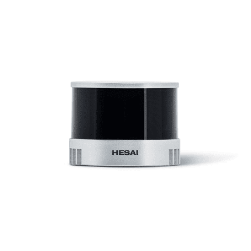
Hesai Technology XT16 High-Precision 360° Mid-Range Lidar

₹504,819.00 (Inclusive of all taxes)
Out of Stock

The Hesai Technology XT16 is a high-precision 360° scanning LiDAR sensor designed for mid-range 3D perception and mapping. It delivers dense point cloud data for integration into autonomous navigation systems, robotics platforms, and industrial automation solutions requiring accurate environmental modeling.

Features

  • High-resolution 360° scanning with 320,000 points per second
  • Extended mid-range detection from 0.05 meters up to 120 meters
  • High measurement accuracy of ±1 cm for precise 3D mapping
  • Wide vertical field of view of 30° for comprehensive environmental perception
  • Compact and lightweight design (800g) for easy system integration

Out of stock

Description

The Hesai Technology XT16 Mid-Range LiDAR utilizes time-of-flight (ToF) laser ranging technology to generate a real-time, high-density 3D point cloud of its surroundings. Its 360° horizontal rotation combined with a 30° vertical field of view provides comprehensive environmental awareness, critical for obstacle detection, SLAM (Simultaneous Localization and Mapping), and navigation.

Engineered for reliability in dynamic environments, the sensor offers a robust measurement range with high accuracy and precision. Its compact form factor and lightweight construction make it suitable for mobile robotics, autonomous guided vehicles (AGVs), and perimeter security systems where detailed spatial data is required.

Key Features

  • High-Density 360° Scanning: Captures 320,000 points per second for detailed environmental models.
  • Extended Measurement Range: Reliably detects objects from 0.05 m to 120 m.
  • Superior Measurement Accuracy: Delivers range accuracy within ±1 cm for precise positioning.
  • Wide Field of View: 360° horizontal by 30° vertical FOV ensures comprehensive spatial coverage.
  • Fine Angular Resolution: 0.18° (horizontal) x 2° (vertical) resolution for high-definition point clouds.
  • Optimized Mechanical Design: Compact dimensions (Φ76 x 103.2 mm) and low weight (800g) facilitate integration.
  • Robust Data Output: Provides real-time point cloud data via standard communication interfaces (e.g., Ethernet).
  • Industrial-Grade Durability: Built for continuous operation in demanding automation and robotics applications.

Applications

  • Autonomous Mobile Robots (AMRs) & AGVs: For real-time obstacle avoidance, navigation, and 3D SLAM in warehouse and factory environments.
  • Perimeter Security & Surveillance: Providing intrusion detection and tracking through volumetric monitoring of secured areas.
  • Smart Infrastructure & City Mapping: Capturing high-definition 3D maps for urban planning, traffic monitoring, and digital twin creation.
  • Unmanned Aerial & Ground Vehicles: Enabling environmental perception and terrain mapping for autonomous exploration and inspection.
  • Industrial Automation & Logistics: For volume measurement, pallet detection, and automated guided vehicle fleet management.

Technical Specifications

Manufacturer / BrandHesai Technology
Model NumberXT16
Sensor Type360° Rotating Time-of-Flight (ToF) LiDAR
Measurement Range0.05 m to 120 m
Range Accuracy±1 cm
Field of View (FOV)360° (Horizontal) x 30° (Vertical)
Angular Resolution0.18° (Horizontal) x 2° (Vertical)
Data Rate320,000 points per second
DimensionsΦ 76 mm x 103.2 mm (Height)
Weight800 g
Typical ApplicationsAutonomous Vehicles, Robotics, Industrial Automation, Smart Cities, Mapping

Frequently Asked Questions

What is the primary communication interface for the Hesai Technology XT16 LiDAR?

The Hesai Technology XT16 typically uses a high-speed Ethernet interface (e.g., Gigabit Ethernet) for real-time point cloud data transmission. It may also support supplementary communication protocols like CAN or RS232 for control and configuration. Please consult the official datasheet for the specific pinout and connector type.

What are the power requirements for operating the XT16 LiDAR sensor?

The XT16 requires a DC power supply, commonly in the range of 12V to 24V, with specific current draw detailed in its technical manual. It is critical to use a stable, low-noise power source to ensure optimal performance and longevity of the laser and motor components.

How does the angular resolution affect the LiDAR's performance?

The angular resolution (0.18° H x 2° V) determines the density and detail of the point cloud. A finer horizontal resolution allows for better object discrimination at longer ranges, while the vertical resolution defines how many scan layers cover the environment, impacting the detection of overhead or low-lying obstacles.

Is the Hesai Technology XT16 suitable for outdoor use?

Yes, the XT16 is engineered for robust performance in various environments. Its IP rating (typically IP67 or similar) should be verified for specific dust and water ingress protection. The sensor's performance in direct sunlight, rain, or fog should be evaluated against application requirements, as environmental conditions can affect laser ranging accuracy.

Can this LiDAR be integrated with ROS (Robot Operating System)?

Yes, the Hesai Technology XT16 is commonly supported through ROS drivers and SDKs provided by Hesai Technology or the community. These packages allow seamless integration of the point cloud data into the ROS ecosystem for navigation stacks (like move_base), perception pipelines, and visualization tools (RViz).

Package Includes

  • 1 x Hesai Technology XT16 High-Precision 360° Mid-Range Lidar Unit
  • Power and data interface cables (typically included)
  • Mounting hardware and documentation

Additional Information

Weight 0.6 kg
Dimensions 15 × 15 × 18 cm